Another excursion into the New England over the Australia Day long weekend. Revisit of some sites I worked last year, reccy to some sites I'd like to work and two new sites. Lent up being a 806km trip.

Had Rain, Wind and some trying condtions. Up the coast to Wauchope then inland up into the New England. Plan was to be out amongst it for four days and activatve at least nine summits. Well.. "The Best Laid Plans of Mice and Men". I wanted to check out access to the Ben Halls Gap N.P. and get back into Barrington Tops N.P. for the final night.

VK2/NT-026
Left at 10am as I was in no hurry. I was only planning on activating one summit on Friday. Drove the 4½ hr, 410km to the Mummel Gulf N.P. and went in serach of VK2/NW-026.
I went down a couple of fire trails to see how close I could get to the summit. But it started to rain and when you see signs like this ya start making other plans! So I made camp at the Country Swamp Rest Area.

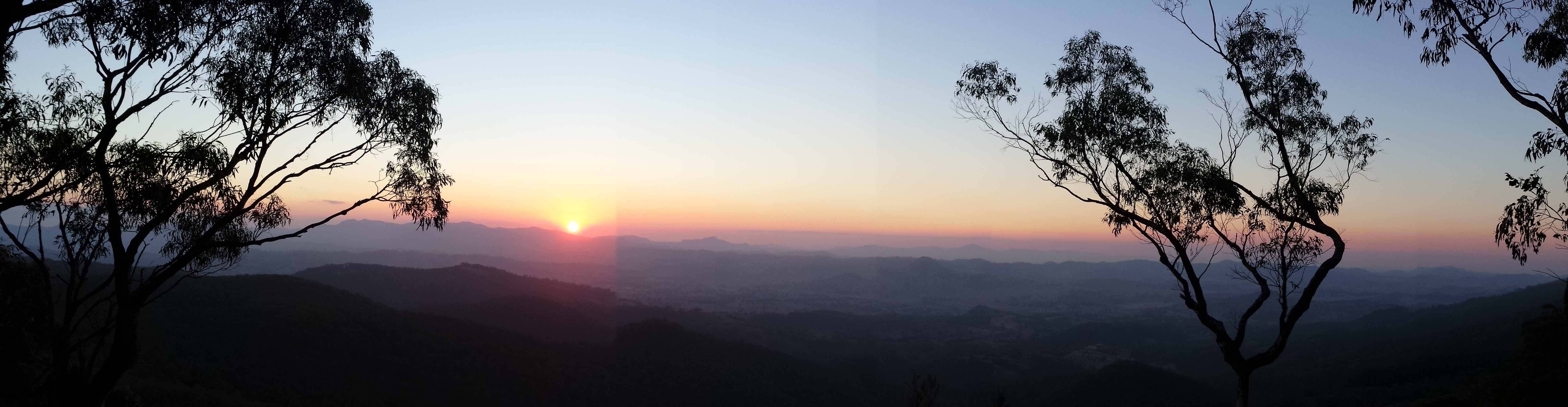
Here is my twisted drive around the area looking for summit access. Got close but not close enough.

If either coming from Walcha or Wauchope take the turn off for Mummel Gulf N.P. down the Enfeild State Forest Road. Keep going straight on when you get to the New Country Swap/Mummel Forest Road. Take the third turn on you right called "Dick's Hut Trig FireTrail". After that your on you own! But it's about 1.2km down that trail. Watch out for Black Snakes. I saw ½ dozen and I wasn't looking for them.


From here it's quiet close to access the first two site I activated on Saturday see for directions.
VK2/NT-008 & VK2/NT-009
Things were much better this time with an antenna that works. Had issues with the 40m part of the switched dipole which needs looking into. But 30m, 20m and 12m worked great. I've also added one of those cheap RMItaly amplifiers into the mix. That extra 12dB of kick helps a bit.
On VK2/NT-008 I made 16 contacts. 3 on 40m, 3 on 30m, 8 on 20m and 2 on 12m. Plus one S2S and NA6MG on 12m which would be my first NA contact as an activator.
Moved over to VK2/NT-009 strapped the squdie to the trig point. Made 17 contacts. 10 on 40m, 4 on 20m, and 2 on 12m. Plus two S2S.


VK2/NW-006 Bakers Downfall Hill
Headed west towards Nundle to work this site in the Nundle State Forest.
If coming from Thunderbolts Way. Turn left into Topdale Road then left onto Nundle Forest Road which is a dirt road in desperate need of a grader! Keep an eye out for the 11km State Forest marker and turn left into the forest. Climb the unnamed road to the summit. Which is a 4WD drive road only as there are some rather large rocks sticking up. Nice clear flat clearing with tussocks of grass. Be a nice camping spot as well as it's in a State Forest and their appeared to be camp fires up there from previous vistors.
If coming from Nundle take a left turn at the top of the hill onto Nundle Forest Road (same intersection as the Hanging Rock Lookout turnoff) and enter the Nundle State Forest. Turn right at the 11km marker.


Was very busy here with 21 contacts. 10 on 40m, 9 on 20m and 2 on 12m. Plus two S2S.
Good telstra mobile coverage - SMS, phone, data.
VK2/NW-002
Stopped at Nundle for a coke and heading down Crawney Road looking for the turnoff for Head of Peel Road to head up into Ben Halls Gap N.P. Got all the way down to the end of the gridded road passing heaps of cattle on the road to be met with a Private Property sign. The road went pass a shearing shed and ended in a locked gate with more cattle beyond it. F#@K!


Wondered what the hell I was going to do. I had wanted to camp the night at VK2/NW-002 and it was already 6pm. Oh what to do? Headed back to Nundle and asked at the Café about access into the N.P. and was told there is no access as the park is land locked on all sides by private property. F#@K!
So I went back up the hill to get to Hanging Rock VK2/NW-026. A faithful decision...
VK2/NW-026 Hanging Rock
Back up the big hill from Nundle (I had already driven pass this turn off) and into the Hanging Rock Lookout Road. 1 km and your there.


I rate this as a very easy SOTA. Dirt road is good, parking at the top, little area off the carpark next to summit that is out of the way. Good views from the lookout.
Since I was spending the night made lots of contacts. 38 contacts. 16 on 40m & 22 on 20m. Plus 1 S2S & 12 EUs and my first EU G4UXH.
Good telstra mobile coverage - SMS, phone, data.
Grrrrr...
Now we get to the title of this post. Just before sunset the wind came up, which is a bit of a worry when I am camping in a tent amongst the trees. A real worry! After about 9:30pm I was being blown off my chair and was having trouble hearing the radio so I gave up and hid in my tent to read a book.
As the night went on the wind got stronger and stronger. I was watching the BOM orbs for Murrurundi Gap and the wind gust were getting worse. Up to 60km and raising. Every time I nodded off a big gust would go through and wake me up and I'd grab my phone and check BOM again. At around 3:30am I gave up! I wasn't going to get any sleep and I was dancing with death if a tree fell on my tent or if the road up to the lookout was blocked. Also the lookout had a sign that said "No Camping" and I didn't want to get busted.
So I packed up in a hurry (like just throw things in the ute). And as I was loading up I notice I had a flat. F#@K and other things were said. Changing the tyre in the dark on a slope is not much fun, and I was done at around 4am. Without a spare tyre I wasn't going to be heading down anymore dirt roads, as I was planning on spending Sunday night in Barrington Tops N.P. and activating another two summits. I decided to head home.
Just before Murrurundi on the New England Hwy I was heading down hill doing about 110kph and this 6' Eastern Gray stops in the middle of the road. I started to go right so I would miss him (I had already dodged about a dozen before hand) and he move to the right. So I corrected to the left and started going that way, and he moved left. Now I wasn't going to be running off the road to miss this bugger. And I didn't want him going under my tyres at this speed. So I centred myself in my lane and lined him up with the middle of the roo bar and he just disappeared underneath the ute. Thanks goodness for roo bars. No damage done except a dented roo bar and a missing number plate.

Got home at about 8am. Had a shower and went to bed.
Epilogue
Was rather impressed with how the switched dipole and squidie worked. When I first setup the antenna it wasn't working at all. So I pulled the feed box apart to find the inner had broken off. A walk back to the ute to get my gas soldering iron and had that fixed in a jiffy. But the 40m VSWR was bad. Not bad enough for the HSWR alarm to show on the radio but still not good. So I need to look into that soon. The other bands on the dipole (30m, 20m & 12m) worked very well and I had unsolicited positive comments on those bands. I strung up the EFD at the 2nd site for a test but the 40m performance was bad again. The EFD needs to have the feed box at least 1m off the ground for the 40m section to work well. Maybe I need to take another 1½m pole with me or think up some sort of guying setup and use sticks or something to keep the feed end off the ground.
I forgot to organise some sort of clock to display UTC.
Pre-dawn driving is dangerous. I won't be doing it in the future unless I have to.
Each night I plan on spending camping I need to know about alterante camping sites that are close by. Just in case.
When doing site research check for maps on the NSW Gov't website Six Maps and fire management maps.
I have to stop planning to activate so many summits when I go away ;)
Also I need to put the HF mobile back in the car. The amount of activations I missed cause I was driving to my sites was irritating.